Does the Property Line Move When the Shoreline Changes at my Waterfront Property?
The place where the waterfront property touches the water (i.e. the shoreline) differs from the other boundaries at the parcel. The upland boundaries have a fixed location but wave action, water currents, wind and other natural forces constantly change the shape and location of shoreline. The important thing for the waterfront property owner is to know whether the changing position of the shoreline shrinks or expands the size of his or her upland acreage. In this article I explain how Virginia riparian property rights law places the property boundary relative to the changing situation at the shoreline.
Courts in Virginia recognize that the shoreline “shifts with the shifting sands”. Finding the property boundary at the shoreline is highly fact-specific. It can also be complicated. Let’s start with the simplest situation.
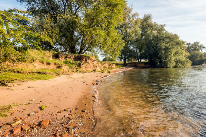
Waterfront Property on a Lake or Pond
If your Virginia waterfront property is located on a lake or a pond the property line does not move, no matter how much the shoreline changes. The “calls” in the deed usually have all the information that you, or your land surveyor, need to locate the property line at the side of your property that faces the lake or pond. Complications can creep in however, if the deed for your waterfront property, and those of the other waterfront owners at the lake or pond, were inexpertly drafted with respect to bottomland ownership. This wrinkle does not change the rule that the property line stays put when the shoreline moves. Rather, the inexpertly drafted deed requires extra effort from you, your land surveyor, or perhaps a court to find the location of the property line at or under the water of the lake or pond.
All of the bottomland beneath the lake or pond will be privately owned, typically (but not necessarily) by the various waterfront property owners. Hopefully the deeds for all of the waterfront property owners, taken together, spell out which waterfront property owner owns which part of the bottomland. As I have written elsewhere in this blog, these types of deeds give the individual waterfront property owner the greatest ability to control fishing, boating, and other activities on the water above the part of the bottomland owned by that person. Sometimes, however, the deeds fail to spell out which waterfront property owner owns which part of the bottomland in which case the courts have developed a set of rules to determine which parts of the bottomland are owned by which of the waterfront property owners. In any case, once the owner determines the proper location of the property line at the side of the property facing the lake or pond, that property line remains at that location no matter how much the shoreline shifts.
Shutterstock: John McLenaghan
Waterfront Property on a River, Creek, Bay or the Shore of the Sea
There are some important exceptions but, for the most part, the Commonwealth of Virginia owns the bottomland situated next to waterfront properties located on a river, creek, bay or the shore of the sea. The general rule for these properties is that the upland extends to “the mean low-water mark but no farther”. The quoted language is taken from Virginia Code §28.2-1202(A); my article elsewhere in this blog explains how Virginia riparian property rights law acknowledges the expansion and reduction of waterfront property through accretion and erosion. The practical effect of this rule is that property boundary changes will follow shoreline changes, subject to some important exceptions. Let’s take a deep dive into some (but not all) of the exceptions.
The Exception for Non-Tidal and Non-Navigable Rivers and Creeks
One important exception applies in the non-tidal rivers and creeks. If these waters are not “navigable” then the waterfront property owner owns the bottomland out to the centerline of the watercourse. In this case, shoreline changes do not move the property line. The U.S. Army Corps of Engineers will, in some cases, conduct a study to determine if a non-tidal river or creek is navigable. Most non-tidal rivers and creeks in Virginia have no navigability determination because studies of this type have not been made at most locations. One option that might substitute for an official navigability determination is the administrative standard used by the Virginia Marine Resources Commission in Section VII of its Subaqueous Guidelines. The VMRC believes it has no jurisdiction if the non-tidal river or creek is draws water from a drainage area of less than five square miles or the instream flow is less than five cubic feet per second. A further option to establish navigability or non-navigability is to seek a court determination, where the legal standard will be whether the waterway “is used, or susceptible of being used, in its ordinary condition, as a highway for commerce, over which trade and travel are or may be conducted in the customary modes of trade and travel on water”.
The Exception for Avulsions
An avulsion is a change to the shape or location of the shoreline brought about by a man-made change (such as adding fill material at the shoreline) or by a rapid change brought about by sudden force of nature (such as when a hurricane causes shoreline erosion). The property boundary does not change in the case of shoreline changes brought about by avulsions.
The Exception for Man-made Canals that Connect to a River, Creek, Bay or the Shore of the Sea

Shutterstock: Lane V. Erickson Real Estate Deed
A land developer owning a large parcel of waterfront property adjoining a river, creek, bay or the shore of the sea may in some instances subdivide the property in multiple buildable lots. The internal, land locked, lots can be converted to more highly valuable waterfront lots if the developer excavates canals that connect the internal, land locked, lots to the water. Changes to the shape or location of shoreline on these canals do not change the property line.
The Exception for King’s Grants
When the first English parties landed in North America in 1607 and beyond, the international Law of Conquest vested in the English Royals title to the newly discovered lands. The Royals held the power to convey this property into private hands until the point in time when the international Law of War terminated their ownership as a result of the Royals having been defeated in the American Revolutionary War. During the period of Royal ownership there are infrequent and rare instances where the English Royals conveyed upland and adjacent bottomland into private ownership through a land conveyance known as a “King’s Grant” (the modern day equivalent is a deed). The person holding a King’s Grant would at some point pass title by deeding it to others, giving rise to a chain of title through which a few waterfront property owners in Virginia now rightly claim ownership of land on a river, creek, bay or the shore of the sea that is founded on a King’s Grant. To the extent that the land conveyed in a King’s Grant encompassed upland together with bottomland, shoreline changes at these properties leaves the property line unchanged.
Our waterfront property law attorneys litigated a case where we persuaded the court to honor our client’s ownership of bottom on the Rose River in Madison County. Click here to learn more
Conclusion
Finding the property boundary at the shoreline is highly fact-specific. It can also be complicated. Contact Jim Lang if you need help at your waterfront property in Virginia. Of course, you can always contact Jim for his advice and assistance in connection with any specific needs or questions.
About The Author