VA Riparian & Waterfront Property Rights at December 2018 VMRC Meeting
"VMRC decisions have direct and immediate consequences affecting the riparian property rights of Virginia's water front property owners. The VMRC makes these decisions at monthly meetings which are open to public. We attend the monthly VMRC meeting to represent our clients or as observers, and provide our readers a summary of the important cases."
The Virginia Marine Resources Commission (VMRC) is the state agency that manages Virginia’s marine resources. The VMRC regulates the fisheries and shellfish industries and issues permits for encroachments over state-owned submerged lands. It also manages the Virginia Wetlands Act, and the Coastal Primary Sand Dune Protection Act. VMRC decisions have direct and immediate consequences affecting the riparian property rights of Virginia's waterfront property owners. The VMRC makes these decisions at monthly meetings which are open to public. We attend the monthly VMRC meetings to represent our clients or as observers, and provide our readers a summary of the important cases.
The December meeting took place on December 11, 2018 at 9:30. Due to a major snowfall in the Richmond area two days earlier, Associate Commissioner J.J. Minor and Counsel Kelci Block were absent.
First up were projects over $500,000.00 with no objections and VMRC staff recommendation for approval. New Ken County requested authorization to install an 8,000,000 gallon per day raw water intake in the Pamunkey River. Appalachian Power Company requested authorization to construct 21 individual aerial crossings (telecom cable) of sections of the McClure River. The Town of Cape Charles requested authorization to install a 735 foot long offshore stone breakwater in the Chesapeake Bay at a location 2,500 feet west of Cape Charles Harbor. Wagman Heavy Civil, Inc. requested a modification to a previously issued permit to allow an additional 2,500 square feet of temporary stone causeway in the Rappahannock River as part of an interstate 95 construction project. The Commission unanimously approved all four projects on an 8-0 vote (Associate Commissioner J.J. Minor absent).
Regarding contested infrastructure cases, our proprietary data shows that, so far in 2018, the Commission has approved 92% of the contested infrastructure permit applications that have come before it for hearing and decision. On contested oyster leases, our proprietary data shows that, so far in 2018, the Commission has approved 60% of the contested oyster lease applications that have come before it for hearing and decision.
Next the Commission took up the contested cases. There were five; three were infrastructure projects and two were oyster leases. Regarding contested infrastructure cases, our proprietary data shows that, so far in 2018, the Commission has approved 92% of the contested infrastructure permit applications that have come before it for hearing and decision. On contested oyster leases, our proprietary data shows that, so far in 2018, the Commission has approved 60% of the contested oyster lease applications that have come before it for hearing and decision. Today, all three contested infrastructure cases received Commission approval, along with both oyster lease applications.
Helen Kidwell (JPA #18-0623)
Ms. Kidwell owns a home at the western tip of Willoughby Spit in Norfolk, immediately north of interstate 64. Notwithstanding the $34.5M sand nourishment project that widened seven miles of beachfront in the East Ocean View, Ocean View and Willoughby Spit neighborhoods, completed in May 2017, Ms. Kidwell’s property is losing sand, which is causing the failure of the bulkhead that protects her property from erosion. The many miles of north facing properties stretching along the length of Willoughby Spit are the beneficiaries of the beach nourishment project. Ms. Kidwell’s property, at the tip of Willoughby Spit, faces west. A recently installed revetment at the terminus of Willoughby Spit was blamed as the reason that her property is being “starved” of sand. As explained in another article on this blog, the onshore and offshore migration of sand in a coastal area is a complex and highly dynamic process. Ms. Kidwell’s proposed to remove the failing bulkhead and install 75 feet of riprap to protect her shoreline against erosion. The project required a permit under the Coastal Primary Sand Dune and Beaches Act (Va. Code §§28.2-1400 to -1420) (“The Dunes Act”).
Localities may, if they wish, administer The Dunes Act. Norfolk formerly exercised this authority but no longer does so, which means that administering The Dunes Act in Norfolk is now the responsibility of the VMRC. (A similar development – the City of Chesapeake no longer administers the Virginia Tidal Wetlands Act, Va. Code §§28.2-1300 to -1320, which means that the VMRC now handles all tidal wetlands permitting for projects in City of Chesapeake.)
As explained in another article on this blog, our experience in working with The Dunes Act includes designing an amendment to The Dunes Act that was enacted into law during the 2017 session of The General Assembly.
The VMRC staff recommended approval of Ms. Kidwell’s project. Associate Commissioner Christy Everett asked whether a “living shoreline” might be a preferable solution. Riprap is a “hardened shoreline”. As explained by the National Oceanic and Atmospheric Administration living shorelines benefit the environment -- which includes people – by purifying water, buffering floods, reducing erosion, storing carbon, and attracting wildlife to habitat. During major storms, a living, natural shoreline performs better than a hardened shoreline. Predictably, the response was that the “hardened shoreline” was cheaper than a “living shoreline”. However, cost estimates for the two options were not presented at the hearing so the price difference was not disclosed. It seems that this would have been useful information for the Commission to consider as it exercised its discretion in choosing between the two available options.
The Commission unanimously approved Ms. Kidwell’s infrastructure project on an 8-0 vote (Associate Commissioner J.J. Minor absent).
Virginia Electric and Power Company (JPA 18-1438)
The next item on the VMRC’s agenda was another infrastructure permit request to construct 365 feet of riprap revetment as another phase of shoreline stabilization work at the Dominion Chesapeake Energy Center on the Southern Branch of the Elizabeth River in Chesapeake. The project requires a wetlands permit from the VMRC pursuant to Va. Code §§28.2-1300 to -1320 (because City of Chesapeake has opted to no longer administer the Virginia Tidal Wetlands Act) and a subaqueous permit pursuant to Va. Code §28.2-1205.
The discussion in the immediately prior (Kidwell) matter apply equally to this matter. However, it was the oil collection system that grabbed the attention of the Commission on this project. There is a continuous oil sheen on the river emanating from the Dominion Chesapeake Energy Center property. The first thought is to find the source of the leaking oil and eliminate it. The Warren Deal, an environmental specialist with Dominion Energy, testified that the company’s efforts to find the source of the leaking oil have been fruitless. Thus, in lieu of finding the source and correcting the root cause of the problem, Dominion wants to install a petroleum collection and cap system known as a “LNAPL Trapping-Cap Design”. Commissioner Bowman said that he wants to keep the oil out of the river. His statement drew a prompt nods of approval from all of the Associate Commissioners. Associate Commissioner Tankard asked about the reliability of the oil collection system to which Mr. Deal replied that the system has worked elsewhere but this is the first time that Dominion Energy has used it. Commissioner Bowman wanted to know how many times the system has been used elsewhere. Mr. Deal said it has been used “over a dozen” times.
The Commission unanimously approved VEPCO’s infrastructure project on an 8-0 vote (Associate Commissioner J.J. Minor absent).
The Retreat at Harbor Pointe, LP (JPA #18-0798)
This was the third of three contested infrastructure projects on the agenda at the December meeting. Of the three, this is the only matter where the protestor appeared in person and gave testimony.
The developer wants to build 246 high end apartments on a 17 acre site on the Eastern Branch of the Elizabeth River in Norfolk. The site is immediately east of the spot where the Campostella Bridge touches the south bank of the river. This project is one of two high end residential developments being built next door to active shipyards on the Elizabeth River in the Berkley Section of Norfolk. There is an article on this blog that analyzes the threat posed to operations at an industrial shipyard when a locality gives permission for an incompatible use of the land next door to the industrial facility.
The developer who wants to build this apartment complex is The Lawson Companies, a large corporation with a vast portfolio of apartment complex holdings throughout Virginia and North Carolina. The site is contaminated with lead. Instead of requiring removal of the lead contamination, the Virginia Department of Environmental Quality has decided that the developer can install a cap, which represents a substantial cost savings as opposed to remediation.
The matter is before the VMRC because of a walkway that the City of Norfolk required the developer to install as a condition of getting the zoning approval necessary for the project to be built. The walkway is 1,441 feet long on piles ringing the entire shoreline of the property. The purpose of the walkway is to provide the public access to the shoreline. Because the walkway follows the mean low water line, it encroaches over 7,205 feet of State-owned submerged lands. Va. Code §28.2-1203 forbids (among other things) encroachment over State-owned submerged lands in the absence of a permit issued by VMRC. Va. Code §28.2-1205 provides the means for this developer to obtain the permit.
Associate Commissioner Christy Everett asked to know whether the project would damage vegetated wetlands. The VMRC staff told Ms. Everett that there would be no impact to vegetated wetlands because all of the vegetated wetlands are located channelward of the walkway. Commissioner Bowman said that he found it “interesting” that the City of Norfolk could withhold zoning approval unless the developer acquiesced to the City’s demand that the developer install the walkway. Commissioner Bowman went on to say that this “did not feel right” to him.
The discussion next turned to the protest brought by an adjacent property owner, Juan Davila. He claims that the walkway will cause him to lose access to the navigable waters of the Elizabeth River and the loss of about 30 feet of waterfront property. Associate Commissioner Ballard asked to review the slide showing the property lines. The VMRC staff advised that it was fill activity by Mr. Davila’s neighbor on the opposite side that damaged Mr. Davila’s right of navigation and that the walkway would have no impact.
The Commission unanimously approved this infrastructure project on an 8-0 vote (Associate Commissioner J.J. Minor absent).
Gary Howard (JPA 16-268)
Mr. Howard requests authorization to lease 6.64 acres of oyster planting ground in Simoneaston Bay, Accomack County. The VMRC staff recommended approval. The lone protestor did not attend the hearing.
The Commission unanimously approved this oyster lease on an 8-0 vote (Associate Commissioner J.J. Minor absent).
Katherine Noel Stitely and Charles N. Morrison, Sr. (JPA 2017-019)
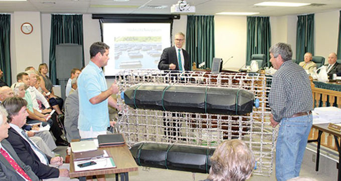
Ms. Stitely and Mr. Morrison request authorization to lease 8.84 acres of oyster planting ground in Simoneaston Bay, Accomack County. This site is in waters very near the site Mr. Howard requested in the immediately prior matter. The VMRC staff recommended approval but at a reduced size – 6.55 acres. The reason for the reduction is to create a “buffer” between the proposed lease site and an adjacent public oyster ground, as demarcated by a “Baylor Line”. Public oyster grounds were mapped during 1892-1895 during the so-called “Baylor Survey”. The lines forming the boundary of these public oyster grounds are called “Baylor Lines”. The VMRC staff’s rationale for creating a buffer strip between the two sites was to reduce possibilities for conflict as between persons harvesting oysters from the public ground and the applicant harvesting oysters from the leased ground.
A protestor submitted a petition with seven signatures, with the basis of the protest being that the proposed lease site was “too close” to the “public rocks”.
The applicant, Ms. Stitely was present. She testified that she opposes the buffer because it reduces the size of her lease area.
The protestor(s) did not appear at the hearing.
The Commission unanimously approved this oyster lease at the size sought by the applicants (8.84 acres) vice the size recommended by the VMRC staff (6.55 acres) on an 8-0 vote (Associate Commissioner J.J. Minor absent).
Audio of the meeting is available at http://mrc.virginia.gov/calendar.shtm.
About The Author